Google Maps has been our companion for years now. From finding the location of casual retreats to examination centres, Google Maps is now an integral part of our lives.
But have you ever wondered how often Google Maps update? Is there a way to find when the next update of your area will happen on Google Maps? In this article, we’ll try to find an answer to this question.
Satellite images
You notice imagery from various sources once you open Google Maps. As per Google Maps expert Matt Manolides, Google uses many third-party agencies such as governments, geological surveys and other commercial imagery providers to update the map regularly. Moreover, the images are taken on different dates, lighting and weather patterns to give you the correct information.
While the images of cities and towns are usually better, the problem arises for remote locations. For remote areas, Google relies on data from satellites. The images from satellites are not that sharp but are manageable.
So, how do these images combine to form the map you see when you open Google Maps? This process is known as photogrammetry, and Google is adept at it. Google combines all the images of the area to form a well-defined and detailed map projection.
The most pertinent question is how often does Google update the satellite images? Well, the answer is somewhere between one to three years. If you’re living in a big city where there are a lot of changes happening at regular intervals, Google will try to update the satellite images regularly, while for medium and small cities with relatively fewer or no changes, the updates will have to wait for at least three years. In short, there isn’t any fixed schedule for satellite imagery updates.
Also read: How to get Google Maps API key?
Street View
Street View is a 360-degree imagery of a particular location. Street View combines data from two sources — one is Google, and the other is content from contributors like you.
So, the whole process involves at least three steps:
- Image collection: Google uses a Street View car, or Trekker fitted with a camera at the top.
- Aligning images: After they have taken the picture, Google then uses other data, such as signals from the car sensors, GPS, and speed, among others, to align the image as required.
- Turning the 2-D images into 360 photos: Google then ‘stitches’ the photos together to create 360-degree images you see on Street View.
Google does not often update the Street View as it takes more resources and manpower. More populated areas tend to get updated relatively less than less populated areas. However, a year or so is the average time you may see an updated Street View.
If you want to know where Google is collecting Street View, head to Google’s Street View page.
Also read: Google Maps no sound: Quick Fix
Street names and routes
Google updates the street names and routes more frequently than the previous two projects. Google takes the help of authorities, feedback from the public and its investigations to rename the streets and routes.
That being said, some changes may take slightly more time to reflect as there are many technical issues and verification procedures that Google has to follow.
Here’s how you can suggest edits to Google Maps:
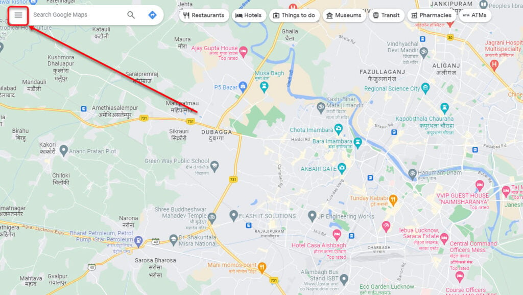
Step 1: Open Google Maps and click on the hamburger menu at the top right.

Step 2: Now click on Edit the map.

You will see the following options:
- Wrong pin location or address
- Missing place
- Add for fixing a road
- Wrong information
- Your opinion about Maps
Click on the option you want to edit, then follow the on-screen instructions to suggest an edit to Google.
Alternatively, you can right-click anywhere on the map and then click on Report a data problem to access the above options.

Also read: How to use Google Maps for boats?
Business names and information
Google Maps also displays tons of businesses and their information, including names, addresses, contact details, opening hours, and reviews.
If you’re a business owner and want to list your business on Google Maps, you can update the information by following the steps given below:
Step 1: Open Google Maps, click on the hamburger menu at the top-right corner, and select Add your business.

Step 2: Enter your business’s name and click Create a business with this name. After that, follow the on-screen instructions to get registered on Google Maps.

Google never or rarely updates this data as it has no way of knowing your business’s current status. Google relies on the information provided by the business owners and the reviewers.
Also read: What is ‘restricted usage road’ on Google Maps?
Traffic and road closures
You may have noticed a yellow or red road sign on Google Maps. This indicates the level of traffic that you’re likely to face when you enter that area.
This data is updated quite often as it is one of the most important pieces of information a commuter requires. Google uses your location, previous data, and the data transmitted anonymously from your phone to paint a picture of the traffic conditions.
As more and more drivers provide this anonymous data, Google combines it and provides you with real-time traffic analysis.
In conclusion, Google Maps provides you with tons of information, not all of which is regularly updated. Depending on the type of information that you seek, it could be updated in minutes or even years.
Also read: How to stop navigation in Google Maps?


